
Add property lines to drone photos for real estate listings
Upload an aerial or drone photo of the listing, say which lot to outline, and get perspective-correct glowing lot lines in about 30 seconds. For homes, acreage, land and commercial parcels.
Paid plans only: Starter $29/month for 50 generations ($14.50 for the first month), Pro $79 for 200. Each photo edit is one generation. No free trial; cancel anytime.
Upload your photo, keep or edit the prompt, press generate. The prompt is already filled in with what paying customers use for this job.
Real before and after
Unretouched outputs of the tool above. The input photos are AI-generated sample scenes, so no client's property is shown.
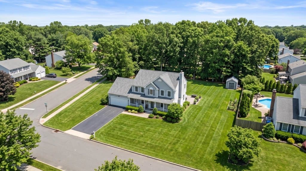
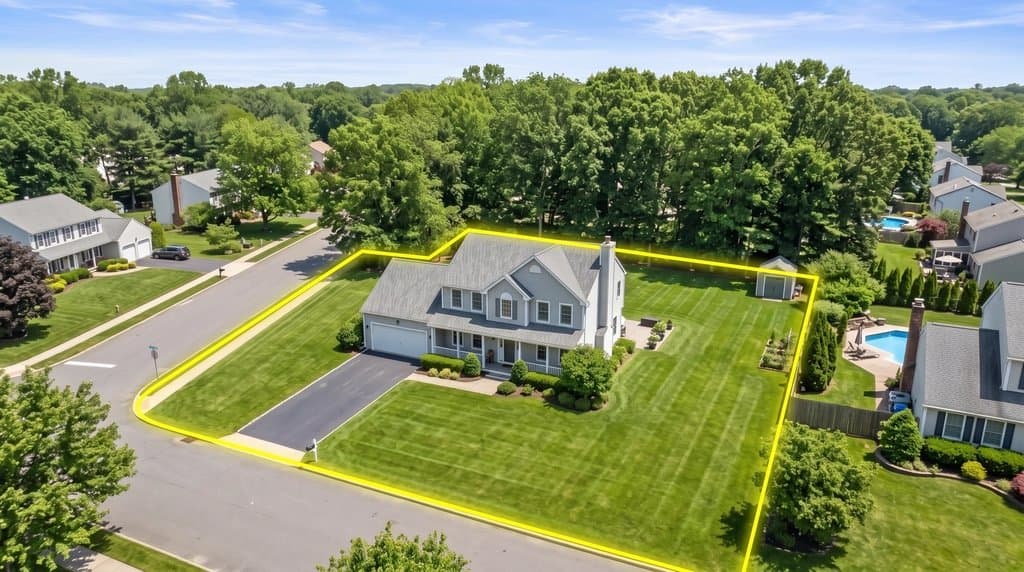
How to do it
- Upload the drone or aerial photo of the listing (JPG or PNG, the higher the resolution the cleaner the lines).
- Say which lot to outline: "the lot of the white house in the center", "the empty parcel left of the barn", "the two lots along the river".
- Name the style you want: glowing yellow, thin white, dashed red, with or without a semi-transparent fill.
- Optionally add labels: "write LOT 4 – 2.3 ACRES inside the boundary" (copy the acreage from the listing or the survey).
- Generate, check the corners against the plat or GIS parcel map, and refine with a short follow-up such as "move the back line to the tree row".
Why listings with lot lines get the call
A drone photo shows the house, the yard and the neighborhood, but it rarely answers the first question a buyer has when looking at an aerial: which part of this is the property? Fences stop short, tree rows belong to the neighbor, and on acreage or land listings there is nothing to see at all. Agents and drone photographers fix this by drawing the boundary on the photo. Done in Photoshop that takes 20 to 40 minutes per image and needs someone who can match the lines to the camera perspective.
With AI Architectures you upload the aerial, describe the lot in a sentence, and the model draws the lines on the ground plane of the photo, so they recede with the terrain instead of floating on top of it. The rest of the image stays as photographed.
What our customers outline
The requests that paying real estate customers run most, in their words:
- “Add bright, glowing yellow property boundary lines to this aerial drone photo.”
- “Thin white property lines, accurately outline the lot shape.”
- “Focus on the purple lots and outline all of them.”
- “Show the lot with a house of similar style and scale to the neighbors” — that job has its own page: house on vacant land.
These customers stay: buyers of this tool kept their plan for about four months on average, longer than any other photo job we track, because every new listing needs a new aerial.
Tips for clean lot lines
Shoot oblique, not straight down, for listings. A 30–45° drone angle with the house in the middle reads best for buyers; a top-down shot is better when you want the shape of a land parcel to match a plat map.
Name landmarks. “From the mailbox along the road to the fence corner, back to the tree line” gives the model anchor points. Without them it guesses the boundary from the most visible edges.
Disclose. Add “property lines approximate” to the photo caption or the listing remarks. When you download from your gallery you can add a visible AI label, and the Listing Kit builds an MLS-ready ZIP with labeled copies, originals and a disclosure text.
Working on a whole listing? Stage the empty rooms and fix the interior photos on the same account — see AI for real estate agents.
FAQ
How do I add property lines to a drone photo?
Upload the drone photo in the tool on this page, tell it which lot to outline and in which color, and press generate. You get the same photo back with boundary lines drawn in perspective in about 30 seconds. No Photoshop, no GIS software.
Are the lot lines accurate enough for a survey?
No. The AI draws the boundary you describe from what it sees in the photo: fences, tree rows, driveways, the road edge. It does not read county parcel data. Use the result as a marketing visual, compare it with the plat or GIS map, and add "approximate lot lines" to the listing, as most MLSs expect.
Can I change the color, thickness or add acreage labels?
Yes. Write it in the prompt: "thin white lines", "dashed red boundary", "semi-transparent green fill", "label it 5.2 ACRES". Customers most often ask for glowing yellow or thin white lines.
Can it outline several lots in one aerial photo?
Yes. Describe each lot ("outline the three lots along the road, each in its own color") or do one lot per generation for full control. For subdivisions, a reference image of the plat helps: upload it next to the drone photo.
What does it cost?
Each generation uses one of your plan's generations: Starter is $29/month for 50 ($14.50 for the first month), Pro is $79/month for 200. There is no free trial. Cancel anytime from your account.
Does it work on satellite images and land listings without a house?
Yes. Vacant land, farms, acreage and commercial parcels work the same way; on featureless land describe the shape ("a rectangle from the gate to the pond") so the AI knows where to draw.
Real estate photo tools
Everything an agent needs for one listing, on one account. See all of them on the real estate photo tools page or read how agents use AI Architectures.
Land, lots & drone photos
- House on vacant landShow buyers a home built on an empty lot.
Listing photo fixes
- Remove window glareClear glare, flash hot spots and blown-out windows.
- Day to twilightTurn a daytime exterior into a dusk shot with lit windows.
- Blue sky replacementSwap a gray sky for a clear one.
- Declutter photosRemove personal items and clutter.
- Remove cars from the drivewayClean up the front of the house.
- Remove snowShow the property in a green season.
- Straighten vertical linesFix leaning walls from wide-angle shots.
Virtual staging
- Listing Kit (batch staging + MLS labels)Stage and fix a whole listing, download with AI disclosure.
- Remove furnitureEmpty a furnished room before restaging.
- Scandinavian stagingLight, minimal staging for empty rooms.
- Coastal stagingRelaxed coastal furniture and decor.
- Screened porch stagingFurnish porches and outdoor rooms.
- Virtual staging guideRules, disclosure and what sells.
Floor plans for listings
- Listing floor plan from a sketch or old planClean, labeled 2D floor plan drawing.